Services
Affordable, Experienced, Safe Drone Services

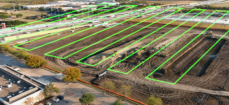
Progress Photos & Videos
Precision Drone Solutions aerial services produce cost-effective, comprehensive, and actionable data that supports planning, monitoring, compliance, and safety in the Architecture, Engineering, and Construction industries. We provide decision makers with the ability to easily assess construction sites, provide volumetric data, track and document progress, inspect structures, and monitor safety and loss prevention initiatives.

Construction and CRE Marketing Photos & Videos
Precision Drone Solutions captures beautiful, high-resolution, cinematic-quality aerial, ground, or interior photos and videos for use in showcasing your project on the web, in CRE videos, and print collateral. We deliver high resolution (4K/6K/8K) content swiftly and in accordance with your shot list.

Site Planning & Drone Deploy Flights
DroneLogix aerial services help gather site topography, perimeter data, and 3D models of existing structures for site planning, survey planning, and building information modeling (BIM). We are very experienced with DroneDeploy missions and other third-party tools that your organization may prefer. We deliver high resolution orthomosaics, video, and 3D models at a significantly lower cost than using traditional or manned aerial services.
Survey-Grade Services
Precision Drone Solutions provides technical drone services such as LiDAR-powered survey-grade services (sub-3cm accuracy) delivering topographical maps with contours at a fraction of the cost of engaging a Texas Professional Land Surveyor. We can also swiftly deliver RTK-based orthomosaic maps tied to control points. This is great for subgrade planning and validation, or to accurately measure cut and fills, and calculate volumes for earthworks or materials for budgeting, monitoring, or cost management. If a surveyor stamp is needed, we partner with Adams Surveying Company.

-
Precision Drone Solutions offers high-quality drone services at a competitive price, often exceeding the content and quality standards of other professional providers.
-
We prioritize safety and compliance, operating in full adherence to FAA regulations and holding OSHA 10/30 training certifications. Our robust processes for managing compliance, risk, service delivery, and proactive client communications effectively shield you from FAA liability.
-
With over 6,300 logged flights (excluding OGI flights), Precision Drone Solutions is among the most experienced service providers in the industry. We are fully insured with $3 million in general and aircraft/UAV liability, $5 million in professional liability, and an additional $1 million in workers' compensation.
-
We are committed to reliable and consistent delivery, expertly managing challenges such as weather, FAA restrictions, and site schedule changes. Our extensive Wide Area Authorizations for virtually all of Texas often enable us to operate in locations where others cannot.
-
Our service is backed by a 100% quality and satisfaction guarantee. With a perfect record of no re-captures across more than 3,700 project flights, we demonstrate our commitment to quality and understanding of client needs. However, we stand firmly behind our work and will re-shoot at no extra cost if necessary.